


<< Our Photo Pages >> Siambr Gladdu Abermorddu - Cairn in Wales in Flintshire
Submitted by SteCymru14 on Saturday, 08 April 2017 Page Views: 2683
Neolithic and Bronze AgeSite Name: Siambr Gladdu Abermorddu Alternative Name: Abermor-ddu BarrowCountry: Wales County: Flintshire Type: Cairn
Nearest Town: Caergwrle Nearest Village: Abermorddu
Map Ref: SJ30695648
Latitude: 53.100997N Longitude: 3.036632W
Condition:
| 5 | Perfect |
| 4 | Almost Perfect |
| 3 | Reasonable but with some damage |
| 2 | Ruined but still recognisable as an ancient site |
| 1 | Pretty much destroyed, possibly visible as crop marks |
| 0 | No data. |
| -1 | Completely destroyed |
| 5 | Superb |
| 4 | Good |
| 3 | Ordinary |
| 2 | Not Good |
| 1 | Awful |
| 0 | No data. |
| 5 | Can be driven to, probably with disabled access |
| 4 | Short walk on a footpath |
| 3 | Requiring a bit more of a walk |
| 2 | A long walk |
| 1 | In the middle of nowhere, a nightmare to find |
| 0 | No data. |
| 5 | co-ordinates taken by GPS or official recorded co-ordinates |
| 4 | co-ordinates scaled from a detailed map |
| 3 | co-ordinates scaled from a bad map |
| 2 | co-ordinates of the nearest village |
| 1 | co-ordinates of the nearest town |
| 0 | no data |
Internal Links:
External Links:
")
After visiting the site I left with more questions than I had when I arrived. Stones lie across the site but are without order. A certain collection of stones to the east of the site could give rise to a chance at a cist or cairn and a long ditch across the top looks interesting too but nothing at all is conclusive.
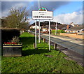
There are local stories of Cawr Gwrle (Cwrle the Giant) who is said to buried at the site. A new housing estate built right next to this site has been named 'Llys Cromlech' (Cromlech/Dolmen Court) but it'sunlikely a cromlech/dolmen ever existed here.
Coflein describes the site as a barrow giving the following information; "A cairn close to a small hollow on the crest of a hill measures 6m in diameter and 0.3m high. Composed of stone consolidated in turf and peat it has been dug into slightly on the E."
Mwynhewch.
You may be viewing yesterday's version of this page. To see the most up to date information please register for a free account.
Do not use the above information on other web sites or publications without permission of the contributor.
Nearby Images from Geograph Britain and Ireland:
©2018(licence)
©2018(licence)
©2018(licence)
©2018(licence)
©2018(licence)
The above images may not be of the site on this page, they are loaded from Geograph.
Please Submit an Image of this site or go out and take one for us!
Click here to see more info for this site
Nearby sites
Key: Red: member's photo, Blue: 3rd party photo, Yellow: other image, Green: no photo - please go there and take one, Grey: site destroyed
Download sites to:
KML (Google Earth)
GPX (GPS waypoints)
CSV (Garmin/Navman)
CSV (Excel)
To unlock full downloads you need to sign up as a Contributory Member. Otherwise downloads are limited to 50 sites.
Turn off the page maps and other distractions
Nearby sites listing. In the following links * = Image available
900m SW 216° Plas Maen Stone* Rock Art (SJ3015555755)
1.2km NE 37° Caer Estyn* Hillfort (SJ314574)
1.9km N 8° Hope Church Early Medieval Stones* Ancient Cross (SJ310584)
2.4km NNW 345° Park in the Past* Museum (SJ301588)
3.1km S 181° Bryn Y Gaer Hillfort and St Paul's Church Hillfort (SJ30585334)
3.7km SE 138° Bryn Alyn* Hillfort (SJ33125370)
4.2km ESE 110° The Atropos Altar Stone* Sculptured Stone (SJ34645497)
5.7km SW 221° Minera Cup Stone* Rock Art (SJ26875225)
5.7km SE 139° Wrexham Gorsedd Circle Modern Stone Circle etc (SJ3436752064)
6.1km WNW 287° Carreg-y-Llech* Standing Stone (Menhir) (SJ24875835)
6.2km ENE 76° St Peter's Well (Denbighshire) Holy Well or Sacred Spring (SJ36735784)
6.4km WNW 284° Bryntirion Round Barrows* Round Barrow(s) (SJ2445058160)
6.5km SSE 157° Wrexham County Borough Museum* Museum (SJ3318950455)
6.5km SE 127° Borras Quarry Neolithic Village Ancient Village or Settlement (SJ35855243)
6.6km W 281° Pen Y Stryt Barrow* Round Barrow(s) (SJ2423057830)
6.7km W 277° Pentre Round Barrow* Round Barrow(s) (SJ2401057440)
7.3km SSE 160° Fairy Oak* Round Barrow(s) (SJ33144962)
7.6km SSE 158° Hillbury* Round Barrow(s) (SJ33424939)
8.4km S 179° Croes-Foel* Round Barrow(s) (SJ307481)
8.4km WSW 241° Maes Maelor* Barrow Cemetery (SJ23275255)
8.8km S 178° Hafod-y-bwch* Round Barrow(s) (SJ309477)
9.3km WSW 258° Llyn Cyfynwy Round Cairn* Round Cairn (SJ215547)
9.7km SW 225° Cefn-y-Gader cairn (2)* Cairn (SJ23774971)
9.8km NW 319° Bryn-yr-Ellyllon* Round Barrow(s) (SJ2434063930)
9.8km SW 221° Cefn-y-Gader cairn 1* Cairn (SJ241492)
View more nearby sites and additional images


 We would like to know more about this location. Please feel free to add a brief description and any relevant information in your own language.
 Wir möchten mehr über diese Stätte erfahren. Bitte zögern Sie nicht, eine kurze Beschreibung und relevante Informationen in Deutsch hinzuzufügen.
 Nous aimerions en savoir encore un peu sur les lieux. S'il vous plaît n'hesitez pas à ajouter une courte description et tous les renseignements pertinents dans votre propre langue.
 Quisieramos informarnos un poco más de las lugares. No dude en añadir una breve descripción y otros datos relevantes en su propio idioma.