


<< Our Photo Pages >> Bach-sylw - Standing Stones in Wales in Carmarthenshire
Submitted by Couplands on Sunday, 25 February 2024 Page Views: 495
Neolithic and Bronze AgeSite Name: Bach-sylwCountry: Wales County: Carmarthenshire Type: Standing Stones
Map Ref: SN16422575
Latitude: 51.899971N Longitude: 4.669738W
Condition:
| 5 | Perfect |
| 4 | Almost Perfect |
| 3 | Reasonable but with some damage |
| 2 | Ruined but still recognisable as an ancient site |
| 1 | Pretty much destroyed, possibly visible as crop marks |
| 0 | No data. |
| -1 | Completely destroyed |
| 5 | Superb |
| 4 | Good |
| 3 | Ordinary |
| 2 | Not Good |
| 1 | Awful |
| 0 | No data. |
| 5 | Can be driven to, probably with disabled access |
| 4 | Short walk on a footpath |
| 3 | Requiring a bit more of a walk |
| 2 | A long walk |
| 1 | In the middle of nowhere, a nightmare to find |
| 0 | No data. |
| 5 | co-ordinates taken by GPS or official recorded co-ordinates |
| 4 | co-ordinates scaled from a detailed map |
| 3 | co-ordinates scaled from a bad map |
| 2 | co-ordinates of the nearest village |
| 1 | co-ordinates of the nearest town |
| 0 | no data |
Internal Links:
External Links:
I have visited· I would like to visit
caroline3642 would like to visit
Couplands visited on 16th Oct 2023 - their rating: Cond: 4 Amb: 3 Access: 4
")
I came across them whilst out walking in mid October 2023, couldn't find any record of them online and submitted the info to Dyfed Archaeological Trust, who confirmed there being no record of them and have added it to Archwilio here.
Note: Two newly discovered standing stones - well done Couplands!
You may be viewing yesterday's version of this page. To see the most up to date information please register for a free account.
")
Do not use the above information on other web sites or publications without permission of the contributor.
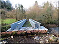
Nearby Images from Geograph Britain and Ireland:
©2010(licence)
©2010(licence)
©2024(licence)
©2010(licence)
©2024(licence)
The above images may not be of the site on this page, they are loaded from Geograph.
Please Submit an Image of this site or go out and take one for us!
Click here to see more info for this site
Nearby sites
Key: Red: member's photo, Blue: 3rd party photo, Yellow: other image, Green: no photo - please go there and take one, Grey: site destroyed
Download sites to:
KML (Google Earth)
GPX (GPS waypoints)
CSV (Garmin/Navman)
CSV (Excel)
To unlock full downloads you need to sign up as a Contributory Member. Otherwise downloads are limited to 50 sites.
Turn off the page maps and other distractions
Nearby sites listing. In the following links * = Image available
638m E 98° Gwal y Filiast* Chambered Tomb (SN17052564)
951m WSW 253° Maen Hir Farm 1* Standing Stone (Menhir) (SN155255)
970m WSW 253° Efailwen-Isaf Barrow* Round Barrow(s) (SN15482550)
977m W 276° Maen Hir Farm 4* Standing Stone (Menhir) (SN15452589)
1.0km WSW 254° Rhos Coynant Round Barrow(s) (SN154255)
1.1km WSW 249° Coynant Maenhir Standing Stone (Menhir) (SN15412540)
1.3km NE 48° St Clydwen's Church Cross Stone* Early Christian Sculptured Stone (SN17452660)
1.5km NW 308° Carreg Fyrddin Standing Stone (Menhir) (SN153267)
1.5km WSW 259° Maen Hir Farm 2 and 3* Standing Stones (SN149255)
1.7km WNW 287° Pantymenyn Ancient Village or Settlement (SN148263)
2.1km WNW 302° Castell Garw* Ancient Village or Settlement (SN147269)
2.1km NNW 336° Carn Besi* Chambered Tomb (SN15632768)
2.2km WNW 302° Glandymawr* Cairn (SN14562702)
2.4km WNW 288° Meini Gwyr* Henge (SN14172658)
2.5km W 281° Glandy Cross Tumulus* Barrow Cemetery (SN140263)
2.6km W 260° Capel Nebo Stone* Standing Stone (Menhir) (SN13852541)
2.6km WNW 287° Yr Allor* Standing Stones (SN13952661)
2.7km WNW 286° Eisteddfa Brynber Round Barrow(s) (SN13842659)
3.3km W 259° Maen Pica Stone* Standing Stone (Menhir) (SN13172524)
3.9km NE 41° Efessangus stone* Early Christian Sculptured Stone (SN191286)
4.3km SE 130° Crosshands* Standing Stones (SN196229)
4.3km SE 130° Cefn Brafle* Chambered Tomb (SN196229)
4.3km N 351° Foel Dyrch, Pentre Galar Cairn (SN159300)
4.7km NW 319° Gors Fawr Stone Circle* Stone Circle (SN13462938)
4.7km NW 320° Gors Fawr Outliers* Standing Stones (SN13512950)
View more nearby sites and additional images


 We would like to know more about this location. Please feel free to add a brief description and any relevant information in your own language.
 Wir möchten mehr über diese Stätte erfahren. Bitte zögern Sie nicht, eine kurze Beschreibung und relevante Informationen in Deutsch hinzuzufügen.
 Nous aimerions en savoir encore un peu sur les lieux. S'il vous plaît n'hesitez pas à ajouter une courte description et tous les renseignements pertinents dans votre propre langue.
 Quisieramos informarnos un poco más de las lugares. No dude en añadir una breve descripción y otros datos relevantes en su propio idioma.