


<< Our Photo Pages >> Achara Standing Stone - Standing Stone (Menhir) in Scotland in Highlands
Submitted by caradoc68 on Thursday, 19 January 2012 Page Views: 7334
Neolithic and Bronze AgeSite Name: Achara Standing Stone Alternative Name: AcharraCountry: Scotland County: Highlands Type: Standing Stone (Menhir)
Nearest Village: Duror
Map Ref: NM98665455
Latitude: 56.639344N Longitude: 5.284889W
Condition:
| 5 | Perfect |
| 4 | Almost Perfect |
| 3 | Reasonable but with some damage |
| 2 | Ruined but still recognisable as an ancient site |
| 1 | Pretty much destroyed, possibly visible as crop marks |
| 0 | No data. |
| -1 | Completely destroyed |
| 5 | Superb |
| 4 | Good |
| 3 | Ordinary |
| 2 | Not Good |
| 1 | Awful |
| 0 | No data. |
| 5 | Can be driven to, probably with disabled access |
| 4 | Short walk on a footpath |
| 3 | Requiring a bit more of a walk |
| 2 | A long walk |
| 1 | In the middle of nowhere, a nightmare to find |
| 0 | No data. |
| 5 | co-ordinates taken by GPS or official recorded co-ordinates |
| 4 | co-ordinates scaled from a detailed map |
| 3 | co-ordinates scaled from a bad map |
| 2 | co-ordinates of the nearest village |
| 1 | co-ordinates of the nearest town |
| 0 | no data |
Internal Links:
External Links:
I have visited· I would like to visit
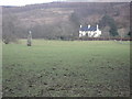
markj99 visited on 1st Dec 2013 - their rating: Cond: 5 Amb: 5 Access: 3 Acharra Standing Stone stands in a field on the SW edge of Duror.
")
The Northern Antiquarian (TNA) also features a page for this site - see their entry for Acharra, Duror, Argyll, which gives details for finding this stone and a brief archaeology & history.
You may be viewing yesterday's version of this page. To see the most up to date information please register for a free account.
")
")
")
Do not use the above information on other web sites or publications without permission of the contributor.
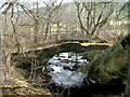
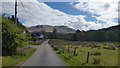
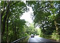
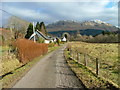
Nearby Images from Geograph Britain and Ireland:
©2010(licence)
©2019(licence)
©2017(licence)
©2010(licence)
©2007(licence)
The above images may not be of the site on this page, they are loaded from Geograph.
Please Submit an Image of this site or go out and take one for us!
Click here to see more info for this site
Nearby sites
Key: Red: member's photo, Blue: 3rd party photo, Yellow: other image, Green: no photo - please go there and take one, Grey: site destroyed
Download sites to:
KML (Google Earth)
GPX (GPS waypoints)
CSV (Garmin/Navman)
CSV (Excel)
To unlock full downloads you need to sign up as a Contributory Member. Otherwise downloads are limited to 50 sites.
Turn off the page maps and other distractions
Nearby sites listing. In the following links * = Image available
7.8km NNE 27° Clach-a-charra* Standing Stone (Menhir) (NN02566134)
7.9km NE 49° Ballachulish House* Chambered Cairn (NN04885951)
8.5km NE 47° Rubha Mor* Cairn (NN05146007)
8.8km NE 50° North Ballachulish* Rock Art (NN057599)
8.9km NE 50° Bishop's Rock* Rock Art (NN058599)
9.4km SW 217° Cairnbane (Portnacroish) Chambered Cairn (NM926473)
9.6km S 181° St Cairrell's Well* Holy Well or Sacred Spring (NM980450)
12.6km S 188° Barcaldine* Standing Stones (NM96374213)
14.4km SSW 194° Achacha standing stone* Standing Stone (Menhir) (NM94444075)
14.4km SSW 195° Achacha Cairn* Cairn (NM94364076)
14.8km SSW 212° Eriska Crannog* Crannog (NM90114239)
15.9km SSW 212° Balure Cairns* Cairn (NM89604145)
16.0km SSW 210° Achnamoine 2* Cairn (NM89974104)
16.1km SSW 209° Achnamoine Cairn* Cairn (NM90184082)
16.2km SSW 205° Castle Farm cairns* Cairn (NM91014029)
16.2km SW 226° Cnoc Aingil Cairn (NM86384397)
16.2km SSW 205° Castle Farm standing stone* Standing Stone (Menhir) (NM911402)
16.6km SW 223° Tirefour Castle* Broch or Nuraghe (NM8675542912)
16.6km SSW 203° Culcharron cairn* Cairn (NM913396)
16.7km SW 226° Lismore Grave Slabs* Sculptured Stone (NM8608043445)
16.7km SW 226° Clach na h-ealea (Clachan)* Natural Stone / Erratic / Other Natural Feature (NM86094342)
16.8km SW 226° Carn Mor (Lismore)* Cairn (NM85934354)
17.1km ESE 111° Invercharnan (Glen Etive) Cairn (NN14394761)
17.3km SSW 208° Kintaline Mill Farm Kist* Cist (NM89793971)
17.4km SSE 156° Muirheadstone* Natural Stone / Erratic / Other Natural Feature (NN050383)
View more nearby sites and additional images


 We would like to know more about this location. Please feel free to add a brief description and any relevant information in your own language.
 Wir möchten mehr über diese Stätte erfahren. Bitte zögern Sie nicht, eine kurze Beschreibung und relevante Informationen in Deutsch hinzuzufügen.
 Nous aimerions en savoir encore un peu sur les lieux. S'il vous plaît n'hesitez pas à ajouter une courte description et tous les renseignements pertinents dans votre propre langue.
 Quisieramos informarnos un poco más de las lugares. No dude en añadir una breve descripción y otros datos relevantes en su propio idioma.