

<< Our Photo Pages >> Menhir de Couëtcas - Standing Stone (Menhir) in France in Pays de la Loire:Loire-Atlantique
Submitted by TheCaptain on Tuesday, 15 February 2011 Page Views: 3019
Neolithic and Bronze AgeSite Name: Menhir de Couëtcas Alternative Name: Menhir de CoicasCountry: France Département: Pays de la Loire:Loire-Atlantique Type: Standing Stone (Menhir)
Nearest Town: Saint-Nazaire Nearest Village: St-André-des-Eaux
Latitude: 47.307989N Longitude: 2.342056W
Condition:
| 5 | Perfect |
| 4 | Almost Perfect |
| 3 | Reasonable but with some damage |
| 2 | Ruined but still recognisable as an ancient site |
| 1 | Pretty much destroyed, possibly visible as crop marks |
| 0 | No data. |
| -1 | Completely destroyed |
| 5 | Superb |
| 4 | Good |
| 3 | Ordinary |
| 2 | Not Good |
| 1 | Awful |
| 0 | No data. |
| 5 | Can be driven to, probably with disabled access |
| 4 | Short walk on a footpath |
| 3 | Requiring a bit more of a walk |
| 2 | A long walk |
| 1 | In the middle of nowhere, a nightmare to find |
| 0 | No data. |
| 5 | co-ordinates taken by GPS or official recorded co-ordinates |
| 4 | co-ordinates scaled from a detailed map |
| 3 | co-ordinates scaled from a bad map |
| 2 | co-ordinates of the nearest village |
| 1 | co-ordinates of the nearest town |
| 0 | no data |
Internal Links:
External Links:
I have visited· I would like to visit
johnstone visited on 2nd Jul 2013 - their rating: Cond: 2 Amb: 2 Access: 4
TheCaptain couldn't find on 8th Jun 2005 At the village of Avrillac, near St-André-des-Eaux, is marked a dolmen and menhir on my maps. I parked my van and had a good look all around, including a 3 kilometre walk around various lanes, but I saw nothing, and there was nobody to ask. Whatever megalithic remains there might be here are either in somebodies garden, or hidden away out of sight in the large wooded area.
Having just crossed the Loire, I am now in Brittany, and I thought that finding these stones would get easier from now on, especially after the multitudes of signposted menhirs I had found this afternoon.
")
At the village of Avrillac, near St-André-des-Eaux, is marked a dolmen and menhir on my maps. I parked my van and had a good look all around, including a 3 kilometre walk around various lanes, but I saw nothing, and there was nobody to ask. Whatever megalithic remains there might be here are either in somebodies garden, or hidden away out of sight in the large wooded area.
Having just crossed the Loire, I am now in Brittany, and I thought that finding these stones would get easier from now on, especially after the multitudes of signposted menhirs I had found this afternoon.
Wikipedia article
Liste des sites mégalithiques de la Loire-Atlantique
Information and Pictures:
t4t35.fr
You may be viewing yesterday's version of this page. To see the most up to date information please register for a free account.
")
Do not use the above information on other web sites or publications without permission of the contributor.
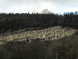
Nearby Images from Flickr


The above images may not be of the site on this page, but were taken nearby. They are loaded from Flickr so please click on them for image credits.
Click here to see more info for this site
Nearby sites
Click here to view sites on an interactive map of the areaKey: Red: member's photo, Blue: 3rd party photo, Yellow: other image, Green: no photo - please go there and take one, Grey: site destroyed
Download sites to:
KML (Google Earth)
GPX (GPS waypoints)
CSV (Garmin/Navman)
CSV (Excel)
To unlock full downloads you need to sign up as a Contributory Member. Otherwise downloads are limited to 50 sites.
Turn off the page maps and other distractions
Nearby sites listing. In the following links * = Image available
34m N 6° Allée Couverte de Coëtcas Passage Grave
930m WNW 299° La Grée Dolmen Burial Chamber or Dolmen
4.0km WNW 283° Menhir de Bissin* Standing Stone (Menhir)
4.2km NNW 328° L'Ile de la Chapelle Menhir Standing Stone (Menhir)
4.3km W 261° Dolmen de Careil Burial Chamber or Dolmen
4.6km N 360° Croix de Sandun Dolmen* Burial Chamber or Dolmen
4.7km NNW 338° Dolmen de Lévérac Burial Chamber or Dolmen
4.7km N 355° Tertre de Bretineau* Long Barrow
4.9km N 7° Menhir de la Grée (Guérande) Standing Stone (Menhir)
5.8km ENE 75° Dolmen de la Garenne (St Andre)* Burial Chamber or Dolmen
6.3km NNW 346° Kerbourg Dolmen 2* Burial Chamber or Dolmen
6.3km SE 131° Dissignac Tumulus* Chambered Cairn
6.3km NNW 346° Kerbourg Dolmen 1* Passage Grave
6.5km N 4° Rocher Du Rohain* Rock Outcrop
6.6km N 360° Dolmens de Crugo Burial Chamber or Dolmen
6.6km NNW 340° La Pierre Blanche (Kerbourg)* Standing Stone (Menhir)
6.6km W 272° La Pierre de Saillé* Standing Stone (Menhir)
6.9km N 2° Kerdanestre Menhir Christianisé* Standing Stone (Menhir)
7.0km E 88° Dolmen de Cuneix Burial Chamber or Dolmen
7.3km NNW 349° Pont de Gras* Ancient Trackway
7.7km N 1° Keralio Croix Menhir* Standing Stone (Menhir)
7.8km NNE 20° Dolmens dit les Roches de Baudin Burial Chamber or Dolmen
7.8km SSE 152° Sainte Marguerite Au Pé Dolmen* Passage Grave
8.1km E 84° Menhir de la Pierre Blanche (Aucard)* Standing Stone (Menhir)
8.4km WNW 282° Menhir de Kerignon Standing Stone (Menhir)
View more nearby sites and additional images


 We would like to know more about this location. Please feel free to add a brief description and any relevant information in your own language.
 Wir möchten mehr über diese Stätte erfahren. Bitte zögern Sie nicht, eine kurze Beschreibung und relevante Informationen in Deutsch hinzuzufügen.
 Nous aimerions en savoir encore un peu sur les lieux. S'il vous plaît n'hesitez pas à ajouter une courte description et tous les renseignements pertinents dans votre propre langue.
 Quisieramos informarnos un poco más de las lugares. No dude en añadir una breve descripción y otros datos relevantes en su propio idioma.