 with our Megalithic Portal iPhone app")


<< Our Photo Pages >> Castell Dinerth - Promontory Fort / Cliff Castle in Wales in Ceredigion
Submitted by Hayden on Tuesday, 09 March 2021 Page Views: 763
Medieval (High and Late)Site Name: Castell DinerthCountry: Wales County: Ceredigion Type: Promontory Fort / Cliff Castle
Nearest Town: Aberaeron Nearest Village: Aberarth
Map Ref: SN4949062370
Latitude: 52.238884N Longitude: 4.20565W
Condition:
| 5 | Perfect |
| 4 | Almost Perfect |
| 3 | Reasonable but with some damage |
| 2 | Ruined but still recognisable as an ancient site |
| 1 | Pretty much destroyed, possibly visible as crop marks |
| 0 | No data. |
| -1 | Completely destroyed |
| 5 | Superb |
| 4 | Good |
| 3 | Ordinary |
| 2 | Not Good |
| 1 | Awful |
| 0 | No data. |
| 5 | Can be driven to, probably with disabled access |
| 4 | Short walk on a footpath |
| 3 | Requiring a bit more of a walk |
| 2 | A long walk |
| 1 | In the middle of nowhere, a nightmare to find |
| 0 | No data. |
| 5 | co-ordinates taken by GPS or official recorded co-ordinates |
| 4 | co-ordinates scaled from a detailed map |
| 3 | co-ordinates scaled from a bad map |
| 2 | co-ordinates of the nearest village |
| 1 | co-ordinates of the nearest town |
| 0 | no data |
Internal Links:
External Links:
I have visited· I would like to visit
Hayden visited on 10th Jul 2020 - their rating: Cond: 2 Amb: 5 Access: 2
Hayden have visited here
")
It was destroyed yet again by Lord Rhys in 1164, and came into the possession of Maelgwyn who lost it to his brother, but recovered it in 1199. It is thought to have been completely destroyed by Maelgwyn in 1202 - to prevent it falling into the hands of Llewelyn. It had been razed three times, and changed hands at least six times in a period of about 90 years.
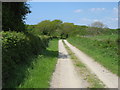
The castle is on a promontory, or spur of land between the Arth and its tributary, the Nant Erthig. There could well have been a prehistoric defence structure here that was adapted in mediaeval times. There is a strong ditch and linear ridge defence on the eastern side, whilst all other sides fall into steep ravines. There seem to be three separate mounds within the site which covers about 3 ha. The entire area is covered with ancient oak and beech woodland with a very diverse ground flora.
You may be viewing yesterday's version of this page. To see the most up to date information please register for a free account.
Do not use the above information on other web sites or publications without permission of the contributor.
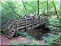
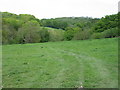
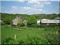
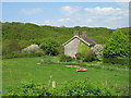
Nearby Images from Geograph Britain and Ireland:
©2014(licence)
©2010(licence)
©2010(licence)
©2010(licence)
©2010(licence)
The above images may not be of the site on this page, they are loaded from Geograph.
Please Submit an Image of this site or go out and take one for us!
Click here to see more info for this site
Nearby sites
Key: Red: member's photo, Blue: 3rd party photo, Yellow: other image, Green: no photo - please go there and take one, Grey: site destroyed
Download sites to:
KML (Google Earth)
GPX (GPS waypoints)
CSV (Garmin/Navman)
CSV (Excel)
To unlock full downloads you need to sign up as a Contributory Member. Otherwise downloads are limited to 50 sites.
Turn off the page maps and other distractions
Nearby sites listing. In the following links * = Image available
2.1km WNW 296° St David's Church Hillfort* Hillfort (SN4761063370)
3.2km W 272° Tyn-y-coed the Second Well* Holy Well or Sacred Spring (SN4626462558)
3.2km W 272° Tyn-y-coed Well* Holy Well or Sacred Spring (SN4626062559)
3.7km W 272° Aberaeron Chalybeate Well* Holy Well or Sacred Spring (SN458626)
4.0km NNE 13° Llanon Defended Enclosure* Ancient Village or Settlement (SN5051066250)
4.1km W 267° Pant-teg Enclosure* Hillfort (SN4533062300)
4.8km SE 135° Castell Perthi-mawr* Hillfort (SN528589)
5.3km ESE 116° Trichrug cairns* Round Cairn (SN542599)
5.4km ENE 61° Llech Gron* Standing Stone (Menhir) (SN5424664851)
6.2km SSE 159° Pen-Y-Gaer (Ceredigion) Hillfort (SN51545648)
7.4km SSW 198° Cwm Castell Hillfort (SN4694055440)
7.5km SE 133° Castell Trefilan* Artificial Mound (SN5489557101)
7.6km NNE 32° Castell Mawr (Llanrhystud) Hillfort (SN5373068660)
7.8km NNE 32° Castell Bach (Llanrhystud)* Hillfort (SN5388068870)
7.9km NNE 31° Pentre-isaf Misc. Earthwork (SN5377069010)
8.3km NNE 26° Pengarreg Defended Enclosure Hillfort (SN5333069710)
8.4km NNE 32° Y Foel Promontory Fort * Promontory Fort / Cliff Castle (SN5418069310)
8.5km SW 236° Cross of Gurhirt (Llanarth)* Early Christian Sculptured Stone (SN42295775)
9.2km ESE 114° Pen-Y-Gaer (Nantcwnlle)* Hillfort (SN57735833)
9.2km NE 37° Gaer Penrhôs* Ancient Village or Settlement (SN5520569555)
9.2km SE 138° Pen-Clawdd-Mawr Hillfort (SN55455535)
10.0km NE 38° Gaer (Gilfachafael)* Ancient Village or Settlement (SN55907005)
10.1km SSW 214° Banc Rhosgoch Fach* Stone Row / Alignment (SN43625409)
10.5km S 184° Castell Moeddyn Ancient Village or Settlement (SN48495195)
11.1km S 189° Castell Moeddyn Fach Ancient Village or Settlement (SN47495143)
View more nearby sites and additional images


 We would like to know more about this location. Please feel free to add a brief description and any relevant information in your own language.
 Wir möchten mehr über diese Stätte erfahren. Bitte zögern Sie nicht, eine kurze Beschreibung und relevante Informationen in Deutsch hinzuzufügen.
 Nous aimerions en savoir encore un peu sur les lieux. S'il vous plaît n'hesitez pas à ajouter une courte description et tous les renseignements pertinents dans votre propre langue.
 Quisieramos informarnos un poco más de las lugares. No dude en añadir una breve descripción y otros datos relevantes en su propio idioma.