

<< Text Pages >> East Crossley - Ancient Village or Settlement in Scotland in Aberdeenshire
Submitted by vicky on Monday, 26 August 2002 Page Views: 7093
Multi-periodSite Name: East CrossleyCountry: Scotland County: Aberdeenshire Type: Ancient Village or Settlement
Map Ref: NO871968 Landranger Map Number: 38
Latitude: 57.062063N Longitude: 2.214332W
Condition:
| 5 | Perfect |
| 4 | Almost Perfect |
| 3 | Reasonable but with some damage |
| 2 | Ruined but still recognisable as an ancient site |
| 1 | Pretty much destroyed, possibly visible as crop marks |
| 0 | No data. |
| -1 | Completely destroyed |
| 5 | Superb |
| 4 | Good |
| 3 | Ordinary |
| 2 | Not Good |
| 1 | Awful |
| 0 | No data. |
| 5 | Can be driven to, probably with disabled access |
| 4 | Short walk on a footpath |
| 3 | Requiring a bit more of a walk |
| 2 | A long walk |
| 1 | In the middle of nowhere, a nightmare to find |
| 0 | No data. |
| 5 | co-ordinates taken by GPS or official recorded co-ordinates |
| 4 | co-ordinates scaled from a detailed map |
| 3 | co-ordinates scaled from a bad map |
| 2 | co-ordinates of the nearest village |
| 1 | co-ordinates of the nearest town |
| 0 | no data |
Be the first person to rate this site - see the 'Contribute!' box in the right hand menu.
Internal Links:
External Links:
Ancient Settlement in Aberdeenshire
Have you visited this site? Please add a comment below.
You may be viewing yesterday's version of this page. To see the most up to date information please register for a free account.
Do not use the above information on other web sites or publications without permission of the contributor.
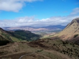
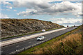
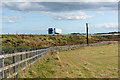
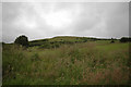
Nearby Images from Geograph Britain and Ireland:
©2019(licence)
©2019(licence)

©2019(licence)
©2007(licence)
©2006(licence)
The above images may not be of the site on this page, they are loaded from Geograph.
Please Submit an Image of this site or go out and take one for us!
Click here to see more info for this site
Nearby sites
Key: Red: member's photo, Blue: 3rd party photo, Yellow: other image, Green: no photo - please go there and take one, Grey: site destroyed
Download sites to:
KML (Google Earth)
GPX (GPS waypoints)
CSV (Garmin/Navman)
CSV (Excel)
To unlock full downloads you need to sign up as a Contributory Member. Otherwise downloads are limited to 50 sites.
Turn off the page maps and other distractions
Nearby sites listing. In the following links * = Image available
639m NE 51° Craigentath Ancient Village or Settlement (NO876972)
1.9km E 87° Auchlee Circle* Stone Circle (NO890969)
2.2km E 85° Auchlee Cairn* Ring Cairn (NO893970)
2.5km WNW 286° Standingstones* Standing Stones (NO847975)
3.1km E 98° Auchquhorthies* Stone Circle (NO90199634)
3.3km ESE 102° Old Bourtreebush* Stone Circle (NO9036096083)
3.6km ENE 79° Cairnwell* Stone Circle (NO90649750)
3.8km ESE 113° Hilton of Cairngrassie* Standing Stone (Menhir) (NO90589531)
4.2km ENE 77° Craighead Badentoy* Stone Circle (NO91189772)
5.8km NNW 344° Binghill* Stone Circle (NJ85520237)
5.9km S 171° Causey Mounth* Ancient Trackway (NO8891)
6.0km WSW 252° South Brachmont Artificial Mound (NO814950)
6.1km NNE 11° Bieldside* Cairn (NJ88340280)
6.6km S 172° Cantlayhills Cairn (NO880903)
6.8km WSW 250° Elsick Mounth* Ancient Trackway (NO807945)
6.9km S 189° White Hill, Aberdeenshire Ancient Village or Settlement (NO860900)
7.0km NE 38° Dunnicaer 1* Class I Pictish Symbol Stone (NJ91500232)
7.1km NNE 19° Friarsfield* Stone Circle (NJ894035)
7.2km SSW 203° Raedykes Roman Camp* Hillfort (NO842902)
7.3km SSW 212° Raedykes NW* Stone Circle (NO832906)
7.3km S 175° Kempston Hill* Standing Stones (NO87678947)
7.4km NE 41° Tollohill* Ring Cairn (NJ91950235)
7.4km SSW 212° Raedykes SE* Stone Circle (NO832905)
7.4km SSW 212° Campstone Hill Ring Cairn (NO832905)
7.7km SW 218° Auquhollie* Standing Stone (Menhir) (NO82339080)
View more nearby sites and additional images


 We would like to know more about this location. Please feel free to add a brief description and any relevant information in your own language.
 Wir möchten mehr über diese Stätte erfahren. Bitte zögern Sie nicht, eine kurze Beschreibung und relevante Informationen in Deutsch hinzuzufügen.
 Nous aimerions en savoir encore un peu sur les lieux. S'il vous plaît n'hesitez pas à ajouter une courte description et tous les renseignements pertinents dans votre propre langue.
 Quisieramos informarnos un poco más de las lugares. No dude en añadir una breve descripción y otros datos relevantes en su propio idioma.