

<< Our Photo Pages >> Danebury Ring - Hillfort in England in Hampshire
Submitted by Andy B on Monday, 29 September 2014 Page Views: 68643
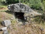
Iron Age and Later PrehistorySite Name: Danebury Ring Alternative Name: Danebury HillCountry: England County: Hampshire Type: Hillfort
Nearest Town: Stockbridge Nearest Village: Nether Wallop
Map Ref: SU32353769 Landranger Map Number: 185
Latitude: 51.137572N Longitude: 1.538997W
Condition:
| 5 | Perfect |
| 4 | Almost Perfect |
| 3 | Reasonable but with some damage |
| 2 | Ruined but still recognisable as an ancient site |
| 1 | Pretty much destroyed, possibly visible as crop marks |
| 0 | No data. |
| -1 | Completely destroyed |
| 5 | Superb |
| 4 | Good |
| 3 | Ordinary |
| 2 | Not Good |
| 1 | Awful |
| 0 | No data. |
| 5 | Can be driven to, probably with disabled access |
| 4 | Short walk on a footpath |
| 3 | Requiring a bit more of a walk |
| 2 | A long walk |
| 1 | In the middle of nowhere, a nightmare to find |
| 0 | No data. |
| 5 | co-ordinates taken by GPS or official recorded co-ordinates |
| 4 | co-ordinates scaled from a detailed map |
| 3 | co-ordinates scaled from a bad map |
| 2 | co-ordinates of the nearest village |
| 1 | co-ordinates of the nearest town |
| 0 | no data |
Internal Links:
External Links:
I have visited· I would like to visit
SteveC whese001 would like to visit
Rulebritannia visited on 10th Apr 2013 - their rating: Cond: 3 Amb: 5 Access: 4 The morning mist engulfed the fort and when I ascended the ramparts I could see very little. However out of the mist I saw horses and a number of sheep.
The livestock gave me a feeling of life with no humans to keep them.
graemefield visited on 5th May 2007 - their rating: Cond: 4 Amb: 4 Access: 3
TheCaptain visited on 1st Jan 2005 - their rating: Cond: 4 Amb: 4 Access: 4
Andy B: would like to visit Here Neil Oliver talks to Sir Barry Cunliffe on a History of Celtic Britain
Angus visited - their rating: Cond: 3 Amb: 5 Access: 5 One of our favourite sites,
JimChampion have visited here
Average ratings for this site from all visit loggers: Condition: 3.5 Ambience: 4.5 Access: 4
")
The hillfort was excavated by Professor Barry Cunliffe between 1969 and 1988 and is one of the best-studied sites of the British Iron Age. Many of the finds are to be found in the nearby Andover Museum of the Iron Age.
Note: Copterdrones visit (and fly over) Danebury (below) and Hambledon Hill - new videos.
You may be viewing yesterday's version of this page. To see the most up to date information please register for a free account.
")
")
")
")
")
")
")
")
")
")
")
")
")
")
Do not use the above information on other web sites or publications without permission of the contributor.
Click here to see more info for this site
Nearby sites
Key: Red: member's photo, Blue: 3rd party photo, Yellow: other image, Green: no photo - please go there and take one, Grey: site destroyed
Download sites to:
KML (Google Earth)
GPX (GPS waypoints)
CSV (Garmin/Navman)
CSV (Excel)
To unlock full downloads you need to sign up as a Contributory Member. Otherwise downloads are limited to 50 sites.
![]()
![]()
Turn off the page maps and other distractions
Nearby sites listing. In the following links * = Image available
703m NNW 331° Danebury East Long Barrow (SU320383)
757m NW 324° Danebury West Long Barrow (SU319383)
5.2km WSW 247° Lopcombe Disc Barrow Round Barrow(s) (SU27563561)
6.1km ESE 120° Stockbridge Down Bowl Barrows* Round Barrow(s) (SU377347)
6.2km NNE 21° Bury Hill (Hampshire)* Hillfort (SU345435)
6.2km ESE 113° Woolbury* Hillfort (SU381353)
6.4km WNW 298° Palestine Bowl Barrow* Round Barrow(s) (SU26684060)
6.5km ESE 117° Stockbridge Down field boundary* Misc. Earthwork (SU382348)
7.2km W 279° Martin's Clump Flint Mine Ancient Mine, Quarry or other Industry (SU252388)
7.3km W 280° Martin's Clump Bowl Barrow Round Barrow(s) (SU25133896)
7.3km W 276° Martin's Clump Long Barrow Long Barrow (SU25053845)
7.5km ENE 66° St Peter and Holy Cross (Wherwell) Ancient Cross (SU39154082)
7.7km NW 307° Quarley Hill* Hillfort (SU262423)
8.5km WNW 291° Grateley Down Barrows* Barrow Cemetery (SU24414074)
9.1km WNW 301° Barrow Field Clumps* Barrow Cemetery (SU2446242274)
9.1km NNE 28° Andover Museum of the Iron Age* Museum (SU36614579)
9.4km E 87° Middlebarn Farm Long Barrow Long Barrow (SU4177438299)
9.6km N 6° Penton Park Bowl Barrow Round Barrow(s) (SU3326247217)
10.1km NE 47° Old Pound Camp Misc. Earthwork (SU39634465)
11.2km SE 141° Withering Corner Barrow Cemetery (SU395291)
11.2km SSE 159° Stubb's Copse Round Barrow(s) (SU36362722)
11.8km SE 138° Farley Mount* Round Barrow(s) (SU403290)
11.9km N 4° Nutbane* Long Barrow (SU33104952)
11.9km S 190° Lockerley Camp* Hillfort (SU304259)
12.1km WSW 257° Battery Hill Bowl Barrow Round Barrow(s) (SU20573485)
View more nearby sites and additional images


 We would like to know more about this location. Please feel free to add a brief description and any relevant information in your own language.
 Wir möchten mehr über diese Stätte erfahren. Bitte zögern Sie nicht, eine kurze Beschreibung und relevante Informationen in Deutsch hinzuzufügen.
 Nous aimerions en savoir encore un peu sur les lieux. S'il vous plaît n'hesitez pas à ajouter une courte description et tous les renseignements pertinents dans votre propre langue.
 Quisieramos informarnos un poco más de las lugares. No dude en añadir una breve descripción y otros datos relevantes en su propio idioma.