


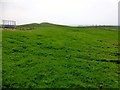
<< Other Photo Pages >> Onziebist - Chambered Cairn in Scotland in Orkney
Submitted by cosmic on Saturday, 10 June 2023 Page Views: 936
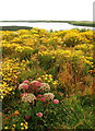
Neolithic and Bronze AgeSite Name: Onziebist Alternative Name: OnziebustCountry: Scotland County: Orkney Type: Chambered Cairn
Nearest Village: Isle of Egilsay
Map Ref: HY4741827807
Latitude: 59.133807N Longitude: 2.920531W
Condition:
| 5 | Perfect |
| 4 | Almost Perfect |
| 3 | Reasonable but with some damage |
| 2 | Ruined but still recognisable as an ancient site |
| 1 | Pretty much destroyed, possibly visible as crop marks |
| 0 | No data. |
| -1 | Completely destroyed |
| 5 | Superb |
| 4 | Good |
| 3 | Ordinary |
| 2 | Not Good |
| 1 | Awful |
| 0 | No data. |
| 5 | Can be driven to, probably with disabled access |
| 4 | Short walk on a footpath |
| 3 | Requiring a bit more of a walk |
| 2 | A long walk |
| 1 | In the middle of nowhere, a nightmare to find |
| 0 | No data. |
| 5 | co-ordinates taken by GPS or official recorded co-ordinates |
| 4 | co-ordinates scaled from a detailed map |
| 3 | co-ordinates scaled from a bad map |
| 2 | co-ordinates of the nearest village |
| 1 | co-ordinates of the nearest town |
| 0 | no data |
Internal Links:
External Links:
")
Access to the interior would have been via a long, low and narrow entrance passage – of which no trace is visible today. The bulk of the structure has been greatly disturbed making any detailed interpretation of the current remains impossible.
Although unexcavated, the structure has clearly been explored in the past. A section of what is presumably a interior wall of the central chamber is visible and part of a side cell’s roof has been removed making it possible to see inside.
The side cell is rectangular at its base, measuring a mere 1.5 metres long by one metre wide. It was accessed by a narrow passage in its eastern side.
The one-metre-long passage is a mere 40cm at its widest and probably about one metre high. It is partially blocked by a layer of material/rubble covering the cell floor to an estimated depth of c.50cm.
Whether the cell infill represents a deliberate act of closure/sealing or accumulated over time is not clear but the fact the roof survived almost intact does make a good case for the former.
The cell is a beautiful example of corbelling – a technique in which stones are overlapped to create a beehive-like roof. The highest point of the roof is less than a metre above the current infill level, suggesting the chamber had an original height of around 1.3 metres.
While recording the condition of the structure it became clear that the face of a single stone slab forming part of the cell’s corbelled roof had incised “decoration” on it. See below in the comments for more on this.
Source: https://archaeologyorkney.com/2023/06/08/onziebist-rock-art/
Note: Recent incised stone "rock art" discovery during a visit to Egilsay’s Onziebist chambered cairn
You may be viewing yesterday's version of this page. To see the most up to date information please register for a free account.
")
")
")
Do not use the above information on other web sites or publications without permission of the contributor.
Nearby Images from Geograph Britain and Ireland:
©2014(licence)
©2012(licence)
©2012(licence)
©2012(licence)
©2011(licence)
The above images may not be of the site on this page, they are loaded from Geograph.
Please Submit an Image of this site or go out and take one for us!
Click here to see more info for this site
Nearby sites
Key: Red: member's photo, Blue: 3rd party photo, Yellow: other image, Green: no photo - please go there and take one, Grey: site destroyed
Download sites to:
KML (Google Earth)
GPX (GPS waypoints)
CSV (Garmin/Navman)
CSV (Excel)
To unlock full downloads you need to sign up as a Contributory Member. Otherwise downloads are limited to 50 sites.
Turn off the page maps and other distractions
Nearby sites listing. In the following links * = Image available
3.3km WSW 240° Braes of Ha’Breck, Wyre. Ancient Village or Settlement (HY445262)
3.5km W 272° Cubbie Roo's Burden* Chambered Cairn (HY43932800)
4.8km NNW 333° Scockness* Ancient Village or Settlement (HY45263214)
4.8km W 267° Taversoe Tuick* Chambered Cairn (HY42572761)
5.1km WNW 284° Tammaskirk* Ancient Village or Settlement (HY42502907)
5.6km NNW 330° Yetnasteen* Standing Stone (Menhir) (HY447327)
5.8km NW 317° Bigland Long (Rousay) Cairn (HY43533214)
5.9km NW 322° Bigland Round* Chambered Cairn (HY438325)
6.0km NW 324° Faraclett Head West Cairn (HY44003270)
6.0km SSW 204° Gairsay Cairn (HY44942237)
6.0km NW 324° Faraclett Head East Cairn (HY43993271)
6.0km W 267° Blackhammer* Chambered Tomb (HY41422761)
6.0km W 264° Knowe of Hunclett* Broch or Nuraghe (HY41442722)
6.5km NW 309° Kierfea Hill (Rousay) Cairn (HY42423196)
6.6km WNW 304° Knowe of Craie* Chambered Cairn (HY41963153)
6.9km W 270° Knowe of Yarso* Chambered Cairn (HY40482795)
7.0km W 267° Langstane (Orkney)* Standing Stone (Menhir) (HY404275)
7.3km W 266° Knowe of Burrian (Frotoft)* Broch or Nuraghe (HY40062745)
7.4km W 271° Knowe of Ramsay* Chambered Cairn (HY40042800)
7.5km W 270° Knowe of Lairo* Chambered Cairn (HY39922796)
7.9km WSW 247° Ness of Woodwick* Broch or Nuraghe (HY40072487)
8.2km SE 131° Ness of Ork Broch or Nuraghe (HY53562238)
8.2km W 271° Viera Lodge Broch or Nuraghe (HY392281)
8.4km SSW 212° Holm of Rendall* Cairn (HY4283220735)
8.7km WSW 240° Knowe of Midgarth* Ancient Village or Settlement (HY39812361)
View more nearby sites and additional images


 We would like to know more about this location. Please feel free to add a brief description and any relevant information in your own language.
 Wir möchten mehr über diese Stätte erfahren. Bitte zögern Sie nicht, eine kurze Beschreibung und relevante Informationen in Deutsch hinzuzufügen.
 Nous aimerions en savoir encore un peu sur les lieux. S'il vous plaît n'hesitez pas à ajouter une courte description et tous les renseignements pertinents dans votre propre langue.
 Quisieramos informarnos un poco más de las lugares. No dude en añadir una breve descripción y otros datos relevantes en su propio idioma.