

<< Our Photo Pages >> Congleton Museum - Museum in England in Cheshire
Submitted by vicky on Saturday, 30 November 2002 Page Views: 10099
MuseumsSite Name: Congleton MuseumCountry: England County: Cheshire Type: Museum
Nearest Town: Congleton
Map Ref: SJ859629 Landranger Map Number: 118
Latitude: 53.163033N Longitude: 2.212346W
Condition:
| 5 | Perfect |
| 4 | Almost Perfect |
| 3 | Reasonable but with some damage |
| 2 | Ruined but still recognisable as an ancient site |
| 1 | Pretty much destroyed, possibly visible as crop marks |
| 0 | No data. |
| -1 | Completely destroyed |
| 5 | Superb |
| 4 | Good |
| 3 | Ordinary |
| 2 | Not Good |
| 1 | Awful |
| 0 | No data. |
| 5 | Can be driven to, probably with disabled access |
| 4 | Short walk on a footpath |
| 3 | Requiring a bit more of a walk |
| 2 | A long walk |
| 1 | In the middle of nowhere, a nightmare to find |
| 0 | No data. |
| 5 | co-ordinates taken by GPS or official recorded co-ordinates |
| 4 | co-ordinates scaled from a detailed map |
| 3 | co-ordinates scaled from a bad map |
| 2 | co-ordinates of the nearest village |
| 1 | co-ordinates of the nearest town |
| 0 | no data |
Be the first person to rate this site - see the 'Contribute!' box in the right hand menu.
Internal Links:
External Links:
I have visited· I would like to visit
TimPrevett has visited here
")
Prehistoric log boat and artefacts found locally including a Bronze Age hoard
Address: Market Square, CW12 1ET
Phone: 01260 276360
Opening Hours: Tuesday to Friday and Sunday - 12-4.30pm, Saturday 10am - 4.30pm
Admission: Small charge
Visit their web site
You may be viewing yesterday's version of this page. To see the most up to date information please register for a free account.
Do not use the above information on other web sites or publications without permission of the contributor.
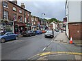
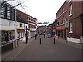
Nearby Images from Geograph Britain and Ireland:
©2021(licence)
©2021(licence)
©2021(licence)
©2023(licence)
©2010(licence)
The above images may not be of the site on this page, they are loaded from Geograph.
Please Submit an Image of this site or go out and take one for us!
Click here to see more info for this site
Nearby sites
Key: Red: member's photo, Blue: 3rd party photo, Yellow: other image, Green: no photo - please go there and take one, Grey: site destroyed
Download sites to:
KML (Google Earth)
GPX (GPS waypoints)
CSV (Garmin/Navman)
CSV (Excel)
To unlock full downloads you need to sign up as a Contributory Member. Otherwise downloads are limited to 50 sites.
Turn off the page maps and other distractions
Nearby sites listing. In the following links * = Image available
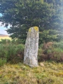
1.8km SW 220° St Marys (Astbury)* Ancient Cross (SJ847615)
1.9km SW 227° Astbury Churchyard* Round Barrow(s) (SJ845616)
2.9km W 280° Loachbrook Farm* Long Barrow (SJ830634)
4.5km ESE 124° Shepherd's Cross* Standing Stone (Menhir) (SJ89626042)
4.6km E 81° Bosley Cloud (1)* Standing Stone (Menhir) (SJ905636)
4.7km E 84° Bosley Cloud (2)* Standing Stone (Menhir) (SJ906634)
4.7km E 98° The Bridestones (Cheshire)* Chambered Tomb (SJ9058962190)
4.8km SW 214° Little Moreton Hall* Round Barrow(s) (SJ832589)
5.0km WNW 288° Somerford Round Barrow Round Barrow(s) (SJ811645)
6.0km NW 309° Swettenham Hall* Round Barrow(s) (SJ813667)
6.5km SSE 160° Red Cross* Ancient Cross (SJ881568)
7.2km NW 306° St Peter (Swettenham) Ancient Cross (SJ80086718)
7.5km E 96° Satan's Stone* Natural Stone / Erratic / Other Natural Feature (SJ93406206)
8.1km SSW 207° All Saints (Church Lawton)* Artificial Mound (SJ82165573)
8.2km E 95° St Helen's Well (Rushton Spencer)* Holy Well or Sacred Spring (SJ94076222)
8.3km SSE 152° Gawton's Well* Holy Well or Sacred Spring (SJ89825555)
8.4km SSE 152° Gawton's Stone* Modern Stone Circle etc (SJ898554)
8.5km ENE 69° Bosley Minn 1* Standing Stone (Menhir) (SJ93886585)
8.5km N 9° Lower Pexhill Round Barrow(s) (SJ872713)
8.6km SW 215° Church Lawton Barrows* Barrow Cemetery (SJ809559)
8.7km ENE 69° Bosley Minn 2 & 3* Standing Stones (SJ940660)
8.7km NE 40° Woodhouse End* Round Barrow(s) (SJ915696)
8.7km ENE 68° Bosley Minn 4 & 5* Standing Stones (SJ940662)
8.8km SW 215° Church Lawton South* Stone Circle (SJ808557)
9.0km NE 42° Gawsworth henge* Henge (SJ920696)
View more nearby sites and additional images


 We would like to know more about this location. Please feel free to add a brief description and any relevant information in your own language.
 Wir möchten mehr über diese Stätte erfahren. Bitte zögern Sie nicht, eine kurze Beschreibung und relevante Informationen in Deutsch hinzuzufügen.
 Nous aimerions en savoir encore un peu sur les lieux. S'il vous plaît n'hesitez pas à ajouter une courte description et tous les renseignements pertinents dans votre propre langue.
 Quisieramos informarnos un poco más de las lugares. No dude en añadir una breve descripción y otros datos relevantes en su propio idioma.