


<< Our Photo Pages >> Unyatuak - Artificial Mound in Scotland in Orkney
Submitted by howar on Sunday, 10 January 2016 Page Views: 1729
Multi-periodSite Name: Unyatuak Alternative Name: UnyatankCountry: Scotland County: Orkney Type: Artificial Mound
Nearest Town: Kirkwall Nearest Village: Balfour Village
Map Ref: HY52451983
Latitude: 59.062773N Longitude: 2.830882W
Condition:
| 5 | Perfect |
| 4 | Almost Perfect |
| 3 | Reasonable but with some damage |
| 2 | Ruined but still recognisable as an ancient site |
| 1 | Pretty much destroyed, possibly visible as crop marks |
| 0 | No data. |
| -1 | Completely destroyed |
| 5 | Superb |
| 4 | Good |
| 3 | Ordinary |
| 2 | Not Good |
| 1 | Awful |
| 0 | No data. |
| 5 | Can be driven to, probably with disabled access |
| 4 | Short walk on a footpath |
| 3 | Requiring a bit more of a walk |
| 2 | A long walk |
| 1 | In the middle of nowhere, a nightmare to find |
| 0 | No data. |
| 5 | co-ordinates taken by GPS or official recorded co-ordinates |
| 4 | co-ordinates scaled from a detailed map |
| 3 | co-ordinates scaled from a bad map |
| 2 | co-ordinates of the nearest village |
| 1 | co-ordinates of the nearest town |
| 0 | no data |
Internal Links:
External Links:
I have visited· I would like to visit
SolarMegalith would like to visit
")
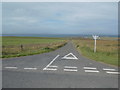
From Balfour village head out onto the Ness Road, B9058, and the site is on the map near Bonnyhill. NMRS record no. HY51NW 7, traditionally the site of a 'Pictish fort', is now thought to be a burial mound but is largely earthen and the stone arrangement on top could be a marker cairn or modern beacon they say. However what with a gravel pit on the other side of the road other material could well have been re-purposed. The mound is still 29' across, but from the originally recorded height of just over a metre it is now only about 0.7m high. The central stones cover an area roughly 3m in diameter - haven't been to the mound yet so see TMA for a photo. From the road there appear to be two similar rises behind this mound.
You may be viewing yesterday's version of this page. To see the most up to date information please register for a free account.
")
")
Do not use the above information on other web sites or publications without permission of the contributor.
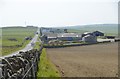
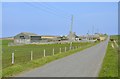
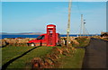
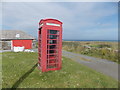
Nearby Images from Geograph Britain and Ireland:
©2012(licence)
©2012(licence)
©2011(licence)
©2015(licence)
©2015(licence)
The above images may not be of the site on this page, they are loaded from Geograph.
Please Submit an Image of this site or go out and take one for us!
Click here to see more info for this site
Nearby sites
Key: Red: member's photo, Blue: 3rd party photo, Yellow: other image, Green: no photo - please go there and take one, Grey: site destroyed
Download sites to:
KML (Google Earth)
GPX (GPS waypoints)
CSV (Garmin/Navman)
CSV (Excel)
To unlock full downloads you need to sign up as a Contributory Member. Otherwise downloads are limited to 50 sites.
Turn off the page maps and other distractions
Nearby sites listing. In the following links * = Image available
1.9km NE 52° Burroughston Broch* Broch or Nuraghe (HY540210)
2.0km WSW 248° Odin Stone* Standing Stone (Menhir) (HY506191)
2.8km NNE 23° Ness of Ork Broch or Nuraghe (HY53562238)
3.0km S 180° Mor Stein* Standing Stone (Menhir) (HY52401685)
3.6km SSE 161° Castle Bloody* Souterrain (Fogou, Earth House) (HY53581644)
4.0km SSW 198° Howe Hill (Howe Farm)* Ancient Village or Settlement (HY51171599)
4.1km SSW 212° Broch of Steiro* Broch or Nuraghe (HY50191635)
4.9km S 182° Hacksness (Shapinsay) Cairn (HY52181491)
5.6km SW 223° Helliar Holm Broch or Nuraghe (HY48591579)
6.3km SW 234° Setter Noost* Ancient Village or Settlement (HY47301621)
6.7km WSW 237° Twi Ness* Cairn (HY46761625)
7.3km SSW 214° Head of Work* Chambered Cairn (HY48341382)
7.9km WNW 288° Gairsay Cairn (HY44942237)
9.4km NNW 327° Onziebist* Chambered Cairn (HY4741827807)
9.6km W 275° Holm of Rendall* Cairn (HY4283220735)
9.6km S 189° Yinstay* Ancient Village or Settlement (HY50841031)
9.8km SSE 167° Castle of Hangie Bay* Stone Fort or Dun (HY54461022)
9.9km W 270° Knowe of Dishero* Broch or Nuraghe (HY42561998)
9.9km SSE 167° The Brough* Ancient Village or Settlement (HY545101)
10.1km NNE 21° Southside (Eday)* Standing Stone (Menhir) (HY56152922)
10.2km NW 308° Braes of Ha’Breck, Wyre. Ancient Village or Settlement (HY445262)
10.2km NNE 26° Green (Eday)* Ancient Village or Settlement (HY5697128987)
10.4km ENE 64° Hillock of Baywest Broch or Nuraghe (HY61902425)
10.5km S 181° Loch of Tankerness* Ancient Village or Settlement (HY522093)
10.6km ENE 61° Lochend (Stronsay) Cairn (HY61762487)
View more nearby sites and additional images


 We would like to know more about this location. Please feel free to add a brief description and any relevant information in your own language.
 Wir möchten mehr über diese Stätte erfahren. Bitte zögern Sie nicht, eine kurze Beschreibung und relevante Informationen in Deutsch hinzuzufügen.
 Nous aimerions en savoir encore un peu sur les lieux. S'il vous plaît n'hesitez pas à ajouter une courte description et tous les renseignements pertinents dans votre propre langue.
 Quisieramos informarnos un poco más de las lugares. No dude en añadir una breve descripción y otros datos relevantes en su propio idioma.