


<< Our Photo Pages >> Llanfihangel Tre'r Beirdd Cross - Ancient Cross in Wales in Anglesey
Submitted by cactus_chris on Tuesday, 08 November 2022 Page Views: 415
Early Medieval (Dark Age)Site Name: Llanfihangel Tre'r Beirdd CrossCountry: Wales County: Anglesey Type: Ancient Cross
Nearest Town: Benllech
Map Ref: SH4588783693
Latitude: 53.327650N Longitude: 4.31554W
Condition:
| 5 | Perfect |
| 4 | Almost Perfect |
| 3 | Reasonable but with some damage |
| 2 | Ruined but still recognisable as an ancient site |
| 1 | Pretty much destroyed, possibly visible as crop marks |
| 0 | No data. |
| -1 | Completely destroyed |
| 5 | Superb |
| 4 | Good |
| 3 | Ordinary |
| 2 | Not Good |
| 1 | Awful |
| 0 | No data. |
| 5 | Can be driven to, probably with disabled access |
| 4 | Short walk on a footpath |
| 3 | Requiring a bit more of a walk |
| 2 | A long walk |
| 1 | In the middle of nowhere, a nightmare to find |
| 0 | No data. |
| 5 | co-ordinates taken by GPS or official recorded co-ordinates |
| 4 | co-ordinates scaled from a detailed map |
| 3 | co-ordinates scaled from a bad map |
| 2 | co-ordinates of the nearest village |
| 1 | co-ordinates of the nearest town |
| 0 | no data |
Internal Links:
External Links:
I have visited· I would like to visit
cactus_chris visited on 1st Oct 2020 - their rating: Cond: 4 Amb: 5 Access: 5
")
According the the Secret Anglesey book by Geraint Wyn Hughes this cross dates from the 13th or 14th Century.
See: https://www.bangor.ac.uk/history-philosophy-and-social-sciences/research/history/archaeology/stones/index.php.en
You may be viewing yesterday's version of this page. To see the most up to date information please register for a free account.
Do not use the above information on other web sites or publications without permission of the contributor.
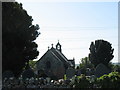
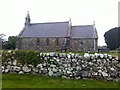
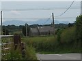
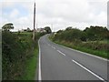
Nearby Images from Geograph Britain and Ireland:
©2007(licence)
©2015(licence)
©2009(licence)
©2006(licence)
©2006(licence)
The above images may not be of the site on this page, they are loaded from Geograph.
Please Submit an Image of this site or go out and take one for us!
Click here to see more info for this site
Nearby sites
Key: Red: member's photo, Blue: 3rd party photo, Yellow: other image, Green: no photo - please go there and take one, Grey: site destroyed
Download sites to:
KML (Google Earth)
GPX (GPS waypoints)
CSV (Garmin/Navman)
CSV (Excel)
To unlock full downloads you need to sign up as a Contributory Member. Otherwise downloads are limited to 50 sites.
Turn off the page maps and other distractions
Nearby sites listing. In the following links * = Image available
362m SE 142° Maen Addwyn* Standing Stone (Menhir) (SH461834)
906m SW 227° Llech Golman* Standing Stone (Menhir) (SH452831)
1.1km WNW 293° Ffynnon Gybi* Holy Well or Sacred Spring (SH44908414)
1.1km WNW 294° Ffynnon Deiniol* Holy Well or Sacred Spring (SH44908416)
1.1km WNW 294° Clorach Wells* Not Known (by us) (SH4487584177)
1.4km WNW 293° Carreg Leidr* Standing Stone (Menhir) (SH446843)
2.4km WNW 285° Llwydiarth Esgob Stone* Rock Art (SH436844)
2.5km NE 43° Ponc y Garreg Hir* Standing Stone (Menhir) (SH47668549)
2.9km E 88° Frigan Field System Misc. Earthwork (SH488837)
3.2km ENE 62° Tyddyn Isaf Burnt Mound Misc. Earthwork (SH4873185067)
3.3km WNW 281° Bedd y Foel* Burial Chamber or Dolmen (SH42698444)
3.3km NW 306° Maen Chwyf* Natural Stone / Erratic / Other Natural Feature (SH43268574)
3.4km ENE 64° Bwlch-Y-Dafarn Enclosed Settlement Ancient Village or Settlement (SH4900085103)
3.5km NW 307° Bryn Dyfrydog* Standing Stone (Menhir) (SH431859)
3.6km ENE 62° Bwlch-Y-Dafarn Settlement Enclosure Ancient Village or Settlement (SH4910585235)
3.6km NE 53° Rhos Lligwy Burnt Mound Misc. Earthwork (SH4888185780)
3.7km ENE 73° Parciau Hillfort Hillfort (SH4945384676)
3.9km NE 53° Coed Newydd Burnt Mounds Misc. Earthwork (SH4904885932)
3.9km ENE 58° Bwlch-Y-Dafarn Ancient Village or Settlement (SH4929285663)
4.1km ENE 73° Ffynnon Allgo Holy Well or Sacred Spring (SH4989684774)
4.4km ENE 75° Cae Marh Ancient Village or Settlement (SH5016784694)
4.5km NE 55° Din Lligwy* Ancient Village or Settlement (SH4970286134)
4.5km ENE 65° Llanallgo Roundhouse Ancient Village or Settlement (SH5008185471)
4.8km ENE 57° Parc Salmon Roundhouse Ancient Village or Settlement (SH4999086149)
4.8km E 98° St Mary (Tynygongl) Ancient Cross (SH50658290)
View more nearby sites and additional images


 We would like to know more about this location. Please feel free to add a brief description and any relevant information in your own language.
 Wir möchten mehr über diese Stätte erfahren. Bitte zögern Sie nicht, eine kurze Beschreibung und relevante Informationen in Deutsch hinzuzufügen.
 Nous aimerions en savoir encore un peu sur les lieux. S'il vous plaît n'hesitez pas à ajouter une courte description et tous les renseignements pertinents dans votre propre langue.
 Quisieramos informarnos un poco más de las lugares. No dude en añadir una breve descripción y otros datos relevantes en su propio idioma.