


<< Text Pages >> Tur A' Bhodaich - Stone Fort or Dun in Scotland in Argyll
Submitted by Anonymous on Thursday, 15 February 2001 Page Views: 4200
Multi-periodSite Name: Tur A' BhodaichCountry: Scotland County: Argyll Type: Stone Fort or Dun
Nearest Town: Lochgilphead Nearest Village: Kilmartin
Map Ref: NM854059 Landranger Map Number: 55
Latitude: 56.197187N Longitude: 5.460795W
Condition:
| 5 | Perfect |
| 4 | Almost Perfect |
| 3 | Reasonable but with some damage |
| 2 | Ruined but still recognisable as an ancient site |
| 1 | Pretty much destroyed, possibly visible as crop marks |
| 0 | No data. |
| -1 | Completely destroyed |
| 5 | Superb |
| 4 | Good |
| 3 | Ordinary |
| 2 | Not Good |
| 1 | Awful |
| 0 | No data. |
| 5 | Can be driven to, probably with disabled access |
| 4 | Short walk on a footpath |
| 3 | Requiring a bit more of a walk |
| 2 | A long walk |
| 1 | In the middle of nowhere, a nightmare to find |
| 0 | No data. |
| 5 | co-ordinates taken by GPS or official recorded co-ordinates |
| 4 | co-ordinates scaled from a detailed map |
| 3 | co-ordinates scaled from a bad map |
| 2 | co-ordinates of the nearest village |
| 1 | co-ordinates of the nearest town |
| 0 | no data |
Be the first person to rate this site - see the 'Contribute!' box in the right hand menu.
Internal Links:
External Links:
Stone Fort or Dun in Argyll
Have you visited this site? Please contribute a description or any thoughts by adding a comment.
You may be viewing yesterday's version of this page. To see the most up to date information please register for a free account.
Do not use the above information on other web sites or publications without permission of the contributor.
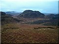
Nearby Images from Geograph Britain and Ireland:
©2005(licence)
©2015(licence)
©2020(licence)
©2020(licence)
©2020(licence)
The above images may not be of the site on this page, they are loaded from Geograph.
Please Submit an Image of this site or go out and take one for us!
Click here to see more info for this site
Nearby sites
Key: Red: member's photo, Blue: 3rd party photo, Yellow: other image, Green: no photo - please go there and take one, Grey: site destroyed
Download sites to:
KML (Google Earth)
GPX (GPS waypoints)
CSV (Garmin/Navman)
CSV (Excel)
To unlock full downloads you need to sign up as a Contributory Member. Otherwise downloads are limited to 50 sites.
![]()
Turn off the page maps and other distractions
Nearby sites listing. In the following links * = Image available
1.5km SE 135° Dun Dubh Stone Fort or Dun (NM864048)
2.0km WSW 237° Dun Na Ban-Oige* Stone Fort or Dun (NM837049)
2.1km NW 318° Sluggan Standing Stone* Standing Stone (Menhir) (NM8404207571)
2.2km WNW 296° Dunan Aula* Cist (NM83420697)
2.2km S 176° Dun Chonallaich* Stone Fort or Dun (NM85440365)
2.3km NW 318° Sluggan Cairn* Cairn (NM83940768)
2.3km SSW 213° Salachary* Stone Row / Alignment (NM8405604024)
2.3km W 279° Barbreck* Standing Stones (NM83130639)
2.3km WSW 247° The Watch Stone (Kintraw)* Standing Stone (Menhir) (NM83200509)
2.4km WSW 247° Kintraw hill platform* Cairn (NM83170507)
2.5km WSW 241° Kintraw (Argyll) Stone Fort or Dun (NM832048)
2.5km WSW 245° Kintraw (Kilmartin)* Standing Stone (Menhir) (NM83050497)
2.7km ESE 109° Torran Standing Stone* Standing Stone (Menhir) (NM8790104877)
2.8km SE 145° Ford Cist* Cist (NM86890356)
2.9km ESE 114° Torran Cup-marked rock* Rock Art (NM87960461)
2.9km SSE 151° Ford Stone (Kilmartin)* Standing Stone (Menhir) (NM8668103317)
2.9km ESE 110° Dun Toiseach (Kilmartin) Stone Fort or Dun (NM88080475)
3.0km W 273° Barbreck Well* Holy Well or Sacred Spring (NM824062)
3.1km SW 229° Bealoch Mor Stone Circle (NM8304)
3.1km S 186° Dun Na Nighinn Stone Fort or Dun (NM84910282)
3.5km S 175° Creag A Chapuill* Stone Fort or Dun (NM855024)
3.6km E 98° Inverliever Cairn (NM889052)
3.6km SW 231° Lochan Druim An Rathaid Cairn (NM825038)
3.6km SSE 156° Loch Ederline* Crannog (NM867025)
3.7km ESE 105° Loch Awe (South) Crannog (NM889048)
View more nearby sites and additional images


 We would like to know more about this location. Please feel free to add a brief description and any relevant information in your own language.
 Wir möchten mehr über diese Stätte erfahren. Bitte zögern Sie nicht, eine kurze Beschreibung und relevante Informationen in Deutsch hinzuzufügen.
 Nous aimerions en savoir encore un peu sur les lieux. S'il vous plaît n'hesitez pas à ajouter une courte description et tous les renseignements pertinents dans votre propre langue.
 Quisieramos informarnos un poco más de las lugares. No dude en añadir una breve descripción y otros datos relevantes en su propio idioma.