


<< Text Pages >> Bransdale Moor Stone Circle - Stone Circle in England in Yorkshire (North)
Submitted by Anonymous on Monday, 08 July 2002 Page Views: 16028
Neolithic and Bronze AgeSite Name: Bransdale Moor Stone CircleCountry: England County: Yorkshire (North) Type: Stone Circle
Nearest Town: Great Ayton
Map Ref: SE604998 Landranger Map Number: 94
Latitude: 54.390109N Longitude: 1.071362W
Condition:
| 5 | Perfect |
| 4 | Almost Perfect |
| 3 | Reasonable but with some damage |
| 2 | Ruined but still recognisable as an ancient site |
| 1 | Pretty much destroyed, possibly visible as crop marks |
| 0 | No data. |
| -1 | Completely destroyed |
| 5 | Superb |
| 4 | Good |
| 3 | Ordinary |
| 2 | Not Good |
| 1 | Awful |
| 0 | No data. |
| 5 | Can be driven to, probably with disabled access |
| 4 | Short walk on a footpath |
| 3 | Requiring a bit more of a walk |
| 2 | A long walk |
| 1 | In the middle of nowhere, a nightmare to find |
| 0 | No data. |
| 5 | co-ordinates taken by GPS or official recorded co-ordinates |
| 4 | co-ordinates scaled from a detailed map |
| 3 | co-ordinates scaled from a bad map |
| 2 | co-ordinates of the nearest village |
| 1 | co-ordinates of the nearest town |
| 0 | no data |
Internal Links:
External Links:
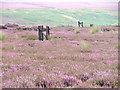
Alleged site of a stone circle, possibly destroyed by forestry work, although the siting is uncertain.
Have you visited this site? Can you confirm if this stone circle has been destroyed or if there are still signs of it in the plantation? Please contribute a description or any thoughts by adding a comment.
You may be viewing yesterday's version of this page. To see the most up to date information please register for a free account.
Do not use the above information on other web sites or publications without permission of the contributor.
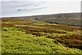
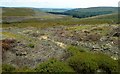
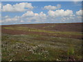
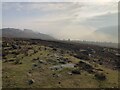
Nearby Images from Geograph Britain and Ireland:
©2019(licence)
©2009(licence)
©2015(licence)
©2022(licence)
©2005(licence)
The above images may not be of the site on this page, they are loaded from Geograph.
Please Submit an Image of this site or go out and take one for us!
Click here to see more info for this site
Nearby sites
Key: Red: member's photo, Blue: 3rd party photo, Yellow: other image, Green: no photo - please go there and take one, Grey: site destroyed
Download sites to:
KML (Google Earth)
GPX (GPS waypoints)
CSV (Garmin/Navman)
CSV (Excel)
To unlock full downloads you need to sign up as a Contributory Member. Otherwise downloads are limited to 50 sites.
Turn off the page maps and other distractions
Nearby sites listing. In the following links * = Image available
511m WSW 246° Crook Staff Hill* Round Barrow(s) (SE5993599584)
624m N 5° Badger Stone (Todd Intake Moor)* Natural Stone / Erratic / Other Natural Feature (NZ6044500423)
1.2km SSW 199° Slape Wath Moor Waymarkers* Marker Stone (SE6002998645)
1.3km ESE 112° High Plantation (Bransdale Moor)* Round Cairn (SE6165499324)
1.6km WNW 295° High Cable Stone (Tripsdale)* Natural Stone / Erratic / Other Natural Feature (NZ5896400446)
1.6km WNW 289° Upper Tripsdale Earthwork* Misc. Earthwork (NZ5887500296)
1.6km WNW 283° Low Cable Stone (Tripsdale)* Natural Stone / Erratic / Other Natural Feature (NZ5878400147)
1.7km S 171° Stump Cross (Bransdale Ridge)* Ancient Cross (SE6068698172)
1.8km NNW 337° Face Stone (Urra Moor)* Standing Stone (Menhir) (NZ5968701442)
1.8km WNW 291° Collar Ridge Marker Stone* Marker Stone (NZ5868400435)
1.9km WNW 298° Collar Ridge Pillar Cairn* Cairn (NZ5866800700)
2.0km NNW 331° Hand Stone (Urra Moor)* Standing Stone (Menhir) (NZ5942701513)
2.0km NE 37° Rudland Rigg Guide Stone GS2* Marker Stone (NZ6161301430)
2.0km NNW 332° Round Hill East* Round Barrow(s) (NZ59430159)
2.0km NW 311° North Gill Head (Urra Moor)* Rock Art (NZ5884101119)
2.1km S 173° Round Barrow 400m south of Stump Cross* Round Barrow(s) (SE6067997744)
2.2km NW 326° Round Hill West* Cairn (NZ5913101602)
2.2km E 86° Cammon Stone* Standing Stone (Menhir) (SE6263199980)
2.4km S 174° Round Barrow 900m west of Colt House Farm* Round Barrow(s) (SE6069997426)
2.5km WSW 243° Ship Stone (Tripsdale)* Natural Stone / Erratic / Other Natural Feature (SE5822698640)
2.6km NNE 17° Jenny Bradley Cross* Ancient Cross (NZ6112502309)
2.8km S 175° Bransdale Ridge (Low Cornfield House)* Round Barrow(s) (SE6068997032)
2.8km ESE 106° Cockan Cross* Ancient Cross (SE6311599071)
2.8km WSW 257° Black Intake Stone (Nab End Moor)* Marker Stone (SE5766099122)
3.0km S 174° Bransdale Ridge (Cowl House)* Round Barrow(s) (SE6073496810)
View more nearby sites and additional images


 We would like to know more about this location. Please feel free to add a brief description and any relevant information in your own language.
 Wir möchten mehr über diese Stätte erfahren. Bitte zögern Sie nicht, eine kurze Beschreibung und relevante Informationen in Deutsch hinzuzufügen.
 Nous aimerions en savoir encore un peu sur les lieux. S'il vous plaît n'hesitez pas à ajouter une courte description et tous les renseignements pertinents dans votre propre langue.
 Quisieramos informarnos un poco más de las lugares. No dude en añadir una breve descripción y otros datos relevantes en su propio idioma.