


<< Our Photo Pages >> Round Barrow 900m west of Colt House Farm - Round Barrow(s) in England in Yorkshire (North)
Submitted by johndhunter on Tuesday, 31 October 2017 Page Views: 904
Neolithic and Bronze AgeSite Name: Round Barrow 900m west of Colt House FarmCountry: England County: Yorkshire (North) Type: Round Barrow(s)
Map Ref: SE6069997426
Latitude: 54.368741N Longitude: 1.067242W
Condition:
| 5 | Perfect |
| 4 | Almost Perfect |
| 3 | Reasonable but with some damage |
| 2 | Ruined but still recognisable as an ancient site |
| 1 | Pretty much destroyed, possibly visible as crop marks |
| 0 | No data. |
| -1 | Completely destroyed |
| 5 | Superb |
| 4 | Good |
| 3 | Ordinary |
| 2 | Not Good |
| 1 | Awful |
| 0 | No data. |
| 5 | Can be driven to, probably with disabled access |
| 4 | Short walk on a footpath |
| 3 | Requiring a bit more of a walk |
| 2 | A long walk |
| 1 | In the middle of nowhere, a nightmare to find |
| 0 | No data. |
| 5 | co-ordinates taken by GPS or official recorded co-ordinates |
| 4 | co-ordinates scaled from a detailed map |
| 3 | co-ordinates scaled from a bad map |
| 2 | co-ordinates of the nearest village |
| 1 | co-ordinates of the nearest town |
| 0 | no data |
Be the first person to rate this site - see the 'Contribute!' box in the right hand menu.
Internal Links:
External Links:
")
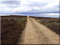
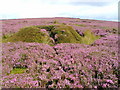
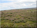
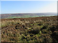
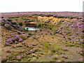
This is Historic England List Entry Number 1010339 and full details and description can be found there. An extract from the list tells us that the monument includes a round barrow situated in a prominent position on the top of Bransdale Ridge. The barrow has an earth and stone mound standing 0.9m high. It is round in shape and 7m in diameter. This mound was surrounded by a ditch up to 3m wide which has become filled-in over the years and is no longer visible as an earthwork. There is a large triangular shaped stone 3.5m long by 1m wide lying on the western flank of the mound.
You may be viewing yesterday's version of this page. To see the most up to date information please register for a free account.
")
")
")
")
Do not use the above information on other web sites or publications without permission of the contributor.
Nearby Images from Geograph Britain and Ireland:
©2010(licence)
©2005(licence)
©2014(licence)
©2019(licence)
©2005(licence)
The above images may not be of the site on this page, they are loaded from Geograph.
Please Submit an Image of this site or go out and take one for us!
Click here to see more info for this site
Nearby sites
Key: Red: member's photo, Blue: 3rd party photo, Yellow: other image, Green: no photo - please go there and take one, Grey: site destroyed
Download sites to:
KML (Google Earth)
GPX (GPS waypoints)
CSV (Garmin/Navman)
CSV (Excel)
To unlock full downloads you need to sign up as a Contributory Member. Otherwise downloads are limited to 50 sites.
Turn off the page maps and other distractions
Nearby sites listing. In the following links * = Image available
318m N 357° Round Barrow 400m south of Stump Cross* Round Barrow(s) (SE6067997744)
394m S 182° Bransdale Ridge (Low Cornfield House)* Round Barrow(s) (SE6068997032)
617m S 178° Bransdale Ridge (Cowl House)* Round Barrow(s) (SE6073496810)
746m N 360° Stump Cross (Bransdale Ridge)* Ancient Cross (SE6068698172)
1.3km S 170° Bransdale Ridge BS2* Marker Stone (SE6092596195)
1.4km NNW 332° Slape Wath Moor Waymarkers* Marker Stone (SE6002998645)
1.9km SW 225° Loosehow Hill MS1* Marker Stone (SE5934496060)
2.0km S 169° Locking Stone (Bransdale)* Marker Stone (SE6110495511)
2.1km SSE 167° Bransdale West Guide Stone GS1* Marker Stone (SE6120495435)
2.1km NNE 27° High Plantation (Bransdale Moor)* Round Cairn (SE6165499324)
2.3km NNW 341° Crook Staff Hill* Round Barrow(s) (SE5993599584)
2.4km N 354° Bransdale Moor Stone Circle Stone Circle (SE604998)
2.6km ENE 72° Three Howes Central (Bransdale)* Round Barrow(s) (SE6314298276)
2.6km ENE 70° Three Howes Northern (Bransdale)* Round Barrow(s) (SE6313398338)
2.6km ENE 74° Three Howes Southern Pair (Bransdale)* Cairn (SE6321598186)
2.7km SSW 211° Money Howe* Round Barrow(s) (SE59379511)
2.7km WNW 297° Ship Stone (Tripsdale)* Natural Stone / Erratic / Other Natural Feature (SE5822698640)
2.9km ENE 56° Cockan Cross* Ancient Cross (SE6311599071)
3.0km N 356° Badger Stone (Todd Intake Moor)* Natural Stone / Erratic / Other Natural Feature (NZ6044500423)
3.1km E 80° Rudland Rigg Guide Stone GS1* Marker Stone (SE6378898039)
3.2km W 280° Nab Ridge* Round Barrow(s) (SE5756497909)
3.2km W 280° Cam House (Chop Gate)* Round Barrow(s) (SE5757097948)
3.2km NE 38° Cammon Stone* Standing Stone (Menhir) (SE6263199980)
3.3km NW 326° Low Cable Stone (Tripsdale)* Natural Stone / Erratic / Other Natural Feature (NZ5878400147)
3.4km NNW 328° Upper Tripsdale Earthwork* Misc. Earthwork (NZ5887500296)
View more nearby sites and additional images


 We would like to know more about this location. Please feel free to add a brief description and any relevant information in your own language.
 Wir möchten mehr über diese Stätte erfahren. Bitte zögern Sie nicht, eine kurze Beschreibung und relevante Informationen in Deutsch hinzuzufügen.
 Nous aimerions en savoir encore un peu sur les lieux. S'il vous plaît n'hesitez pas à ajouter une courte description et tous les renseignements pertinents dans votre propre langue.
 Quisieramos informarnos un poco más de las lugares. No dude en añadir una breve descripción y otros datos relevantes en su propio idioma.