

<< Text Pages >> Ness of Ork - Broch or Nuraghe in Scotland in Orkney
Submitted by SolarMegalith on Friday, 20 January 2012 Page Views: 2747
Iron Age and Later PrehistorySite Name: Ness of Ork Alternative Name: The HillockCountry: Scotland County: Orkney Type: Broch or Nuraghe
Map Ref: HY53562238
Latitude: 59.085793N Longitude: 2.812069W
Condition:
| 5 | Perfect |
| 4 | Almost Perfect |
| 3 | Reasonable but with some damage |
| 2 | Ruined but still recognisable as an ancient site |
| 1 | Pretty much destroyed, possibly visible as crop marks |
| 0 | No data. |
| -1 | Completely destroyed |
| 5 | Superb |
| 4 | Good |
| 3 | Ordinary |
| 2 | Not Good |
| 1 | Awful |
| 0 | No data. |
| 5 | Can be driven to, probably with disabled access |
| 4 | Short walk on a footpath |
| 3 | Requiring a bit more of a walk |
| 2 | A long walk |
| 1 | In the middle of nowhere, a nightmare to find |
| 0 | No data. |
| 5 | co-ordinates taken by GPS or official recorded co-ordinates |
| 4 | co-ordinates scaled from a detailed map |
| 3 | co-ordinates scaled from a bad map |
| 2 | co-ordinates of the nearest village |
| 1 | co-ordinates of the nearest town |
| 0 | no data |
Internal Links:
External Links:
Broch in Orkney
Possible remains of a broch on Shapinsay, preserved as a mound with traces of walls.
MacKie, E. 2002. Roundhouses, Brochs and Wheelhouses of Atlantic Scotland c. 700 BC – AD 500. Part I: The Orkney and Shetland Isles. Oxford: Archaeopress. (p. 250)
You may be viewing yesterday's version of this page. To see the most up to date information please register for a free account.
Do not use the above information on other web sites or publications without permission of the contributor.
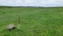
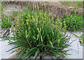
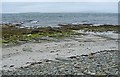
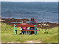
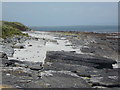
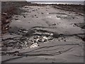
Nearby Images from Geograph Britain and Ireland:
©2023(licence)
©2007(licence)
©2008(licence)
©2015(licence)
©2007(licence)
The above images may not be of the site on this page, they are loaded from Geograph.
Please Submit an Image of this site or go out and take one for us!
Click here to see more info for this site
Nearby sites
Key: Red: member's photo, Blue: 3rd party photo, Yellow: other image, Green: no photo - please go there and take one, Grey: site destroyed
Download sites to:
KML (Google Earth)
GPX (GPS waypoints)
CSV (Garmin/Navman)
CSV (Excel)
To unlock full downloads you need to sign up as a Contributory Member. Otherwise downloads are limited to 50 sites.
Turn off the page maps and other distractions
Nearby sites listing. In the following links * = Image available
1.4km SSE 162° Burroughston Broch* Broch or Nuraghe (HY540210)
2.8km SSW 203° Unyatuak* Artificial Mound (HY52451983)
4.4km SW 221° Odin Stone* Standing Stone (Menhir) (HY506191)
5.6km S 191° Mor Stein* Standing Stone (Menhir) (HY52401685)
5.9km S 179° Castle Bloody* Souterrain (Fogou, Earth House) (HY53581644)
6.8km SSW 200° Howe Hill (Howe Farm)* Ancient Village or Settlement (HY51171599)
6.9km SSW 208° Broch of Steiro* Broch or Nuraghe (HY50191635)
7.3km NNE 20° Southside (Eday)* Standing Stone (Menhir) (HY56152922)
7.4km NNE 27° Green (Eday)* Ancient Village or Settlement (HY5697128987)
7.6km S 190° Hacksness (Shapinsay) Cairn (HY52181491)
8.2km NW 311° Onziebist* Chambered Cairn (HY4741827807)
8.2km SW 216° Helliar Holm Broch or Nuraghe (HY48591579)
8.5km ENE 77° Hillock of Baywest Broch or Nuraghe (HY61902425)
8.5km ENE 72° Lochend (Stronsay) Cairn (HY61762487)
8.6km W 269° Gairsay Cairn (HY44942237)
8.8km SW 225° Setter Noost* Ancient Village or Settlement (HY47301621)
9.1km SW 227° Twi Ness* Cairn (HY46761625)
9.8km WNW 292° Braes of Ha’Breck, Wyre. Ancient Village or Settlement (HY445262)
10.0km SSW 211° Head of Work* Chambered Cairn (HY48341382)
10.3km NNE 13° Eday Manse Cairn (HY56023242)
10.8km W 261° Holm of Rendall* Cairn (HY4283220735)
10.9km NNE 13° Sandyhill Smithy (Eday) Cairn (HY56123299)
11.1km WNW 300° Cubbie Roo's Burden* Chambered Cairn (HY43932800)
11.2km WSW 257° Knowe of Dishero* Broch or Nuraghe (HY42561998)
11.3km NNE 12° Eday Church Chambered Cairn* Chambered Cairn (HY56043344)
View more nearby sites and additional images


 We would like to know more about this location. Please feel free to add a brief description and any relevant information in your own language.
 Wir möchten mehr über diese Stätte erfahren. Bitte zögern Sie nicht, eine kurze Beschreibung und relevante Informationen in Deutsch hinzuzufügen.
 Nous aimerions en savoir encore un peu sur les lieux. S'il vous plaît n'hesitez pas à ajouter une courte description et tous les renseignements pertinents dans votre propre langue.
 Quisieramos informarnos un poco más de las lugares. No dude en añadir una breve descripción y otros datos relevantes en su propio idioma.