


<< Our Photo Pages >> Helmsley Moor RB1 - Round Barrow(s) in England in Yorkshire (North)
Submitted by johndhunter on Wednesday, 11 November 2020 Page Views: 469
Neolithic and Bronze AgeSite Name: Helmsley Moor RB1Country: England County: Yorkshire (North) Type: Round Barrow(s)
Nearest Village: Fangdale Beck
Map Ref: SE5904992216
Latitude: 54.322117N Longitude: 1.093665W
Condition:
| 5 | Perfect |
| 4 | Almost Perfect |
| 3 | Reasonable but with some damage |
| 2 | Ruined but still recognisable as an ancient site |
| 1 | Pretty much destroyed, possibly visible as crop marks |
| 0 | No data. |
| -1 | Completely destroyed |
| 5 | Superb |
| 4 | Good |
| 3 | Ordinary |
| 2 | Not Good |
| 1 | Awful |
| 0 | No data. |
| 5 | Can be driven to, probably with disabled access |
| 4 | Short walk on a footpath |
| 3 | Requiring a bit more of a walk |
| 2 | A long walk |
| 1 | In the middle of nowhere, a nightmare to find |
| 0 | No data. |
| 5 | co-ordinates taken by GPS or official recorded co-ordinates |
| 4 | co-ordinates scaled from a detailed map |
| 3 | co-ordinates scaled from a bad map |
| 2 | co-ordinates of the nearest village |
| 1 | co-ordinates of the nearest town |
| 0 | no data |
Internal Links:
External Links:
")
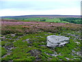
A bronze age round barrow amd though low in height it is well defined, sited on gently sloping ground towards the top of Collis Ridge it would have stood out well in its prime and is thought to have been a territorial marker.
The barrow is Historic England List Entry 1009369 which tells us amongst other things that it has been well dug into in the past leaving a circular mound 0.6m high and 12m in diameter surrounding a hollow.
Pastscape also has information at Monument 57569
You may be viewing yesterday's version of this page. To see the most up to date information please register for a free account.
")
")
Do not use the above information on other web sites or publications without permission of the contributor.
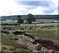
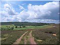
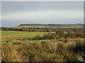
Nearby Images from Geograph Britain and Ireland:
©2005(licence)
©2012(licence)
©2012(licence)
©2020(licence)

©2021(licence)
The above images may not be of the site on this page, they are loaded from Geograph.
Please Submit an Image of this site or go out and take one for us!
Click here to see more info for this site
Nearby sites
Key: Red: member's photo, Blue: 3rd party photo, Yellow: other image, Green: no photo - please go there and take one, Grey: site destroyed
Download sites to:
KML (Google Earth)
GPX (GPS waypoints)
CSV (Garmin/Navman)
CSV (Excel)
To unlock full downloads you need to sign up as a Contributory Member. Otherwise downloads are limited to 50 sites.
Turn off the page maps and other distractions
Nearby sites listing. In the following links * = Image available
513m NW 322° Roppa Cross South* Ancient Cross (SE5872492614)
850m NNW 337° Roppa Cross North* Ancient Cross (SE5869992992)
929m NW 320° Carr Cote Ridge (Laskill Pasture Moor)* Round Barrow(s) (SE5844092920)
2.0km NNW 345° Coniser Howl RB1* Round Barrow(s) (SE5849894180)
2.9km N 7° Money Howe* Round Barrow(s) (SE59379511)
3.4km E 90° Hanging Stone (Pockley Moor)* Standing Stone (Menhir) (SE6241392266)
3.9km N 5° Loosehow Hill MS1* Marker Stone (SE5934496060)
3.9km NE 34° Bransdale West Guide Stone GS1* Marker Stone (SE6120495435)
3.9km NNE 33° Locking Stone (Bransdale)* Marker Stone (SE6110495511)
4.3km NW 316° Limestone Ridge (Bilsdale West Moor)* Round Cairn (SE5599595301)
4.4km NNE 26° Bransdale Ridge BS2* Marker Stone (SE6092596195)
4.9km NNE 21° Bransdale Ridge (Cowl House)* Round Barrow(s) (SE6073496810)
5.0km W 273° Long Hill (Hawnby Moor) MS1* Marker Stone (SE5400192446)
5.1km NNE 20° Bransdale Ridge (Low Cornfield House)* Round Barrow(s) (SE6068997032)
5.1km WNW 287° Round Hill (Hawnby Moor)* Round Barrow(s) (SE5410093616)
5.2km W 272° Long Hill (Hawnby Moor) RB1* Round Barrow(s) (SE5386292307)
5.3km WNW 297° Sour Milk Hills Tumuli* Round Barrow(s) (SE5428194612)
5.5km NNE 18° Round Barrow 900m west of Colt House Farm* Round Barrow(s) (SE6069997426)
5.7km W 277° Hazel Head Wood (Hawnby Moor) RB1* Round Barrow(s) (SE5333592868)
5.7km NW 319° Flat Howe (Bilsdale)* Round Barrow(s) (SE55229651)
5.8km NNE 17° Round Barrow 400m south of Stump Cross* Round Barrow(s) (SE6067997744)
5.9km NNW 346° Nab Ridge* Round Barrow(s) (SE5756497909)
5.9km NNW 346° Cam House (Chop Gate)* Round Barrow(s) (SE5757097948)
6.0km WSW 245° All Saints Church, Hawnby* Ancient Cross (SE53658967)
6.2km NNE 16° Stump Cross (Bransdale Ridge)* Ancient Cross (SE6068698172)
View more nearby sites and additional images


 We would like to know more about this location. Please feel free to add a brief description and any relevant information in your own language.
 Wir möchten mehr über diese Stätte erfahren. Bitte zögern Sie nicht, eine kurze Beschreibung und relevante Informationen in Deutsch hinzuzufügen.
 Nous aimerions en savoir encore un peu sur les lieux. S'il vous plaît n'hesitez pas à ajouter une courte description et tous les renseignements pertinents dans votre propre langue.
 Quisieramos informarnos un poco más de las lugares. No dude en añadir una breve descripción y otros datos relevantes en su propio idioma.